
Our History
Construction Technological Services (CTS) was established in 1994 by our founder and former Managing Director, Mr. D.M. Thilakarathne. Initially, Mr. Thilakarathne founded CTS to provide specialist engineering survey-related services to clients in the private and public sectors. In 2013 we develo...
Explore MoreOur Strengths
32
Years in Business
100
Projects Completed
50
Satisfied Clients
20
Professionals
Professional Services
Vessel Dimentional Control Surveys
Civil Engineering Consultancy Services
Structural/Geodetic Monitoring
Bathymetric Survey
Construction Survey
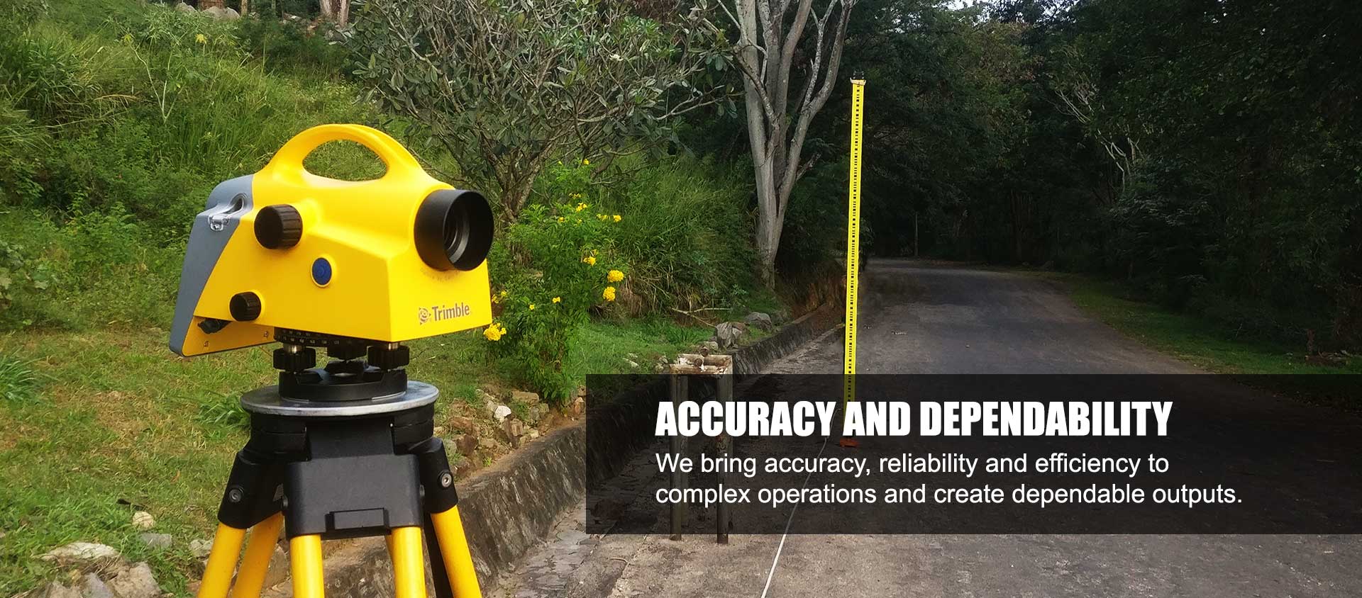
Topographic Survey
Quantity Survey
Mine Survey
Photorealistic 3D Modeling
GIS Related Services
Raster-based spatial modeling and analysis
Satellite image processing & interpretation
Cartography
What We Offer
Geospatial Surveying Engineering & Construction Services.
Establishing a new benchmark for engineering consultancy in Sri Lanka and beyond. Our mission is defined by long-standing client partnerships, bespoke technical solutions, and a commitment to excellence without equal
Project Portfolio
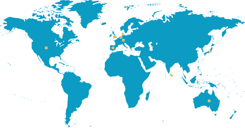
International Clients
Italy
- NextGeo Solutions
People's Republic of China
- Envision Energy International Trading Company
People's Republic of China
- China Machinery Engineering Corporation (CMEC)
India
- Coastal Marine Construction & Engineering Ltd (COMACOE)
Japan
- Nishimatsu JV.
- Hazaama Corporation
Germany
- NOEL International
United Kingdom
- BALFOUR BEATY
- Roughton International
Australia
- Cardno International
- Peraj Mining
Denmark
- MTHojgaard
Holland
- Boscalis International BV
United States
- US Aid
Spain
- Abeinsa Infraestructuras Medio
Civil Engineering Consultancy Services
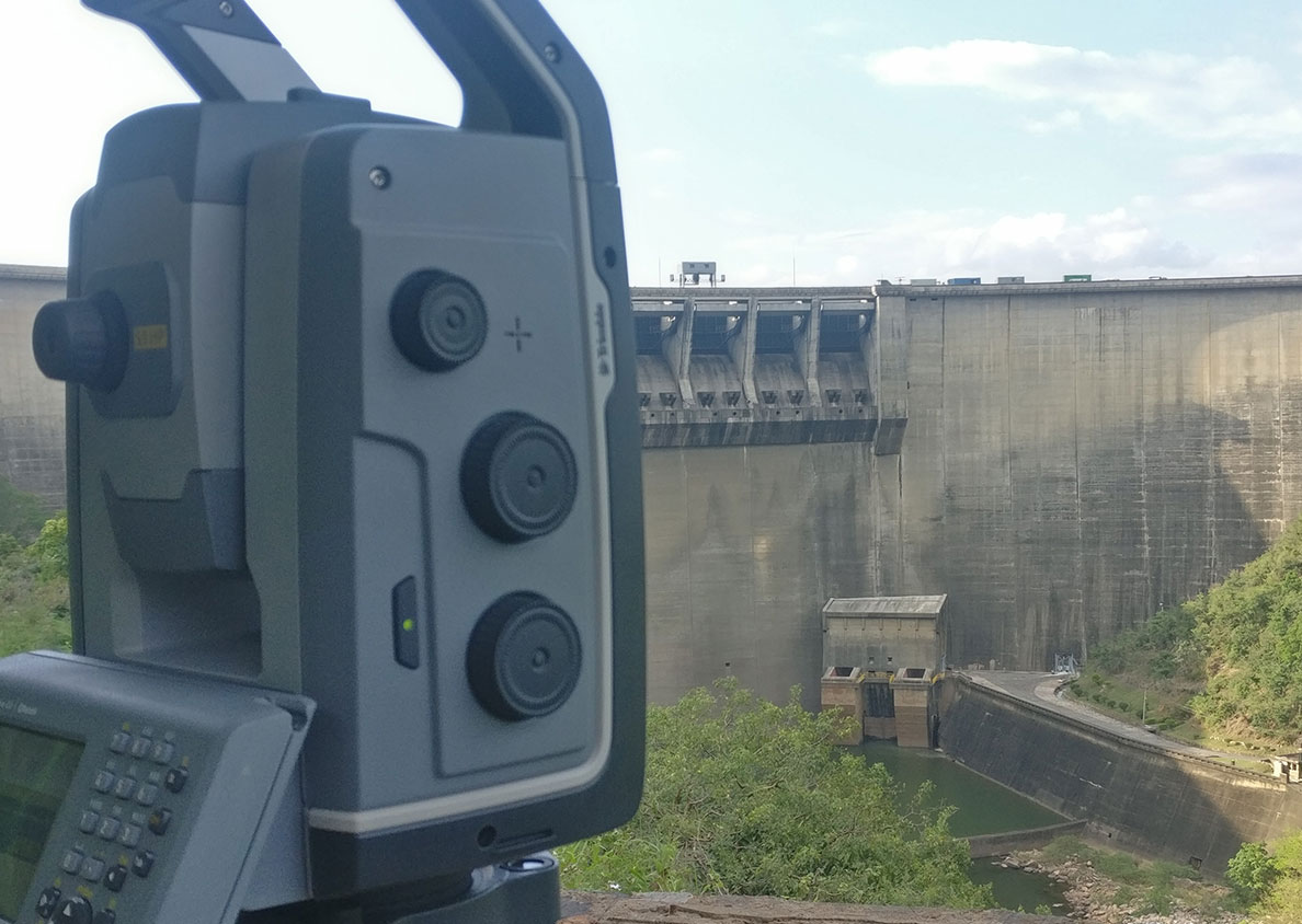
CTS Provides Engineering Consultancy services for Construction Projects. This includes conducting preliminary surveys, environmental and social impact assessments, initial estimation and design, bathymetric surveys, topographic surveys and construction services. In Addition, CTS provides design and estimate services for Irrigation projects.
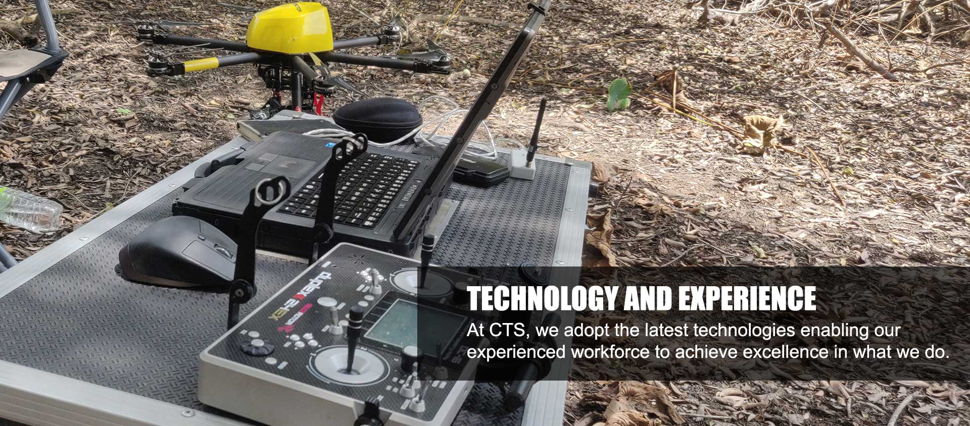
Drone Surveying
Using Unmanned Aerial Vehicles (UAV) for Surveying has driven modern surveying into the next era. It's relative cost-effectiveness and the capability to capture data with multiple sensors such as RGB, multispectral cameras, or LiDAR sensors has allowed surveyors to bring surveying into the 21st century. In addition, drones can capture data in hazardous, hard-to-reach places with unparallel detail and accuracy. CTS has been an early adapter and the pioneer in the Sri Lanka drone survey segment.
Monitoring
Structural and Geodetic monitoring is vital in keeping lives safe while increasing environmental well-being. CTS provides tailor-made manual and automated monitoring systems for projects depending on their client's needs. CTS uses modern geodetic and geotechnical instrumentation and software to monitor and study structures. In addition, CTS has established monitoring systems for structures with national importance.
GIS Related Services
Every industry in the modern-day world uses location-based data to communicate, perform analysis, share information and solve complex problems. CTS can develop, collect, and analyse spatial data with custom GIS solutions for any industry. GIS solutions and remote sensing data can elevate information and analysis for any enterprise with impeccable accuracy.
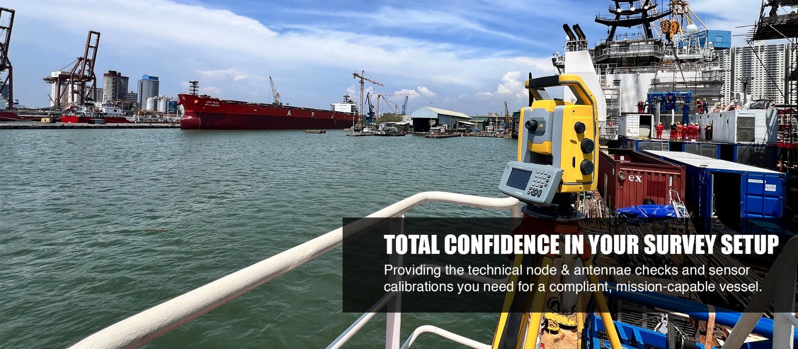
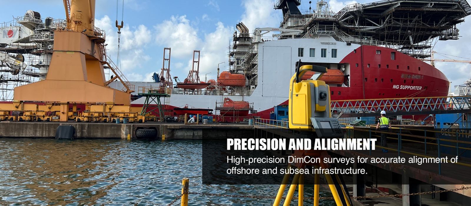
Vessel Dimentional Control Surveys
We provide high-accuracy geometric verification DimCon Surveys to ensure your offshore assets and subsea infrastructure are perfectly aligned and mission-ready.
Are you interested in what we have to offer? Download our corporate brochure for more information
Download Brochure